Google Maps gets a ton of new features including indoor AR navigation
People are traveling less due to the COVID-19 pandemic, but when the industry gets back on its feet, Google Maps will be ready with a really cool feature, which will make it easy to navigate indoors.
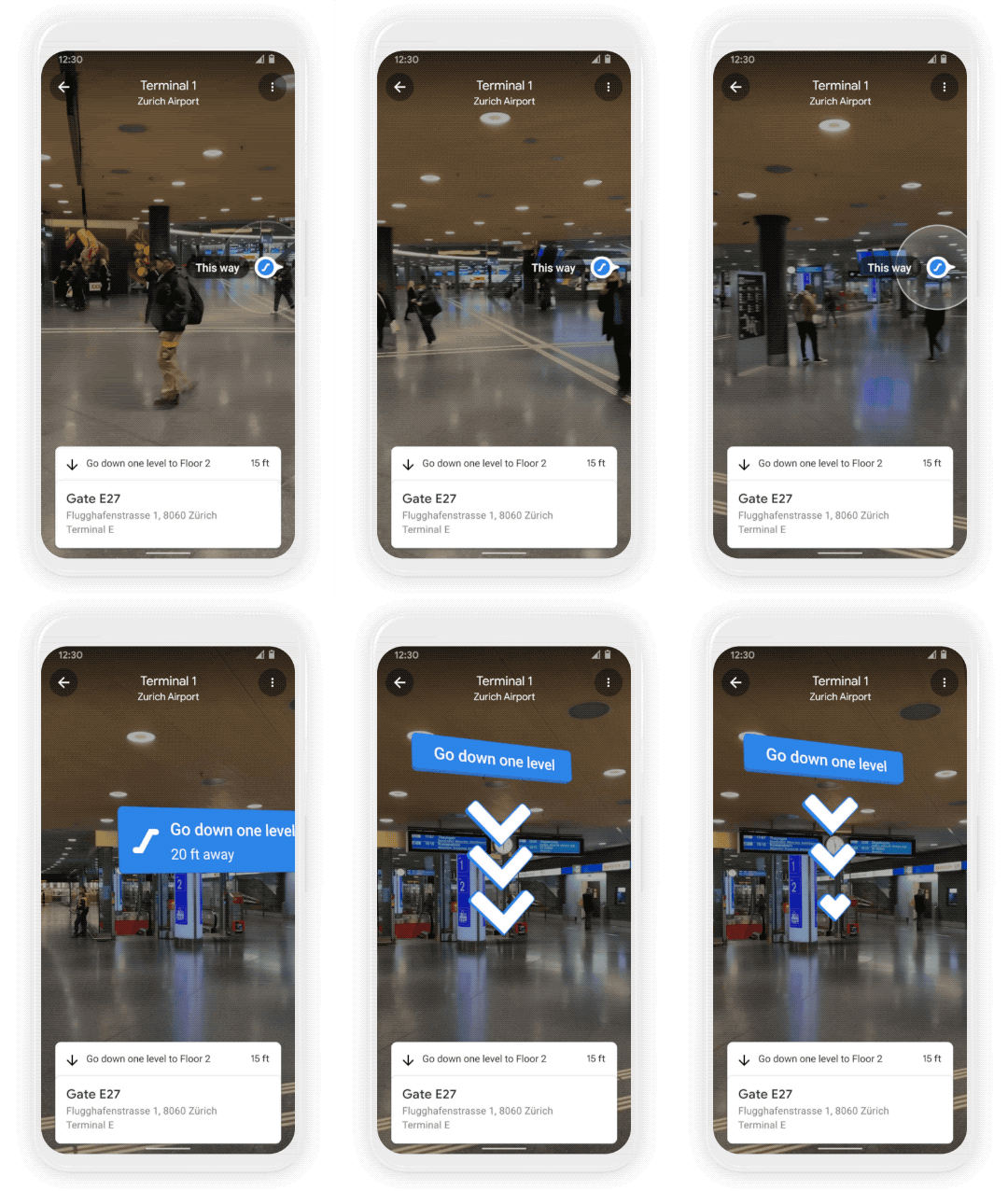
Google on Tuesday announced Maps users will be able to take advantage of Live View in certain indoor locations, including airports, transit stations, and malls. Previously, Live View was used for navigating outdoors.

Image via Google
“If you’re catching a plane or train, Live View can help you find the nearest elevator and escalators, your gate, platform, baggage claim, check-in counters, ticket office, restrooms, ATMs and more,” Google said in a blog post. “Arrows and accompanying directions will point you the right way. And if you need to pick something up from the mall, use Live View to see what floor a store is on and how to get there so you can get in and out in a snap.”
The indoor Live View feature in Google Maps is available now on Android and iOS, and can be used in malls in Chicago, Long Island, Los Angeles, Newark, San Francisco, San Jose, and Seattle. The feature will roll out in the coming months to select airports, malls, and transit stations in Tokyo and Zurich, with more cities to come.

Image via Google
In addition to indoor Live View, Google Maps is introducing other features, too. There’s a new weather layer that will allow users to quickly see current and forecasted conditions. If it’s going to rain, knowing the upcoming forecast might determine how you plan to travel to a certain event. Instead of biking, maybe it will be better to drive. There’s also an air quality layer that will show you how healthy or unhealthy the air is.
Google Maps will also show more eco-friendly options to get around.
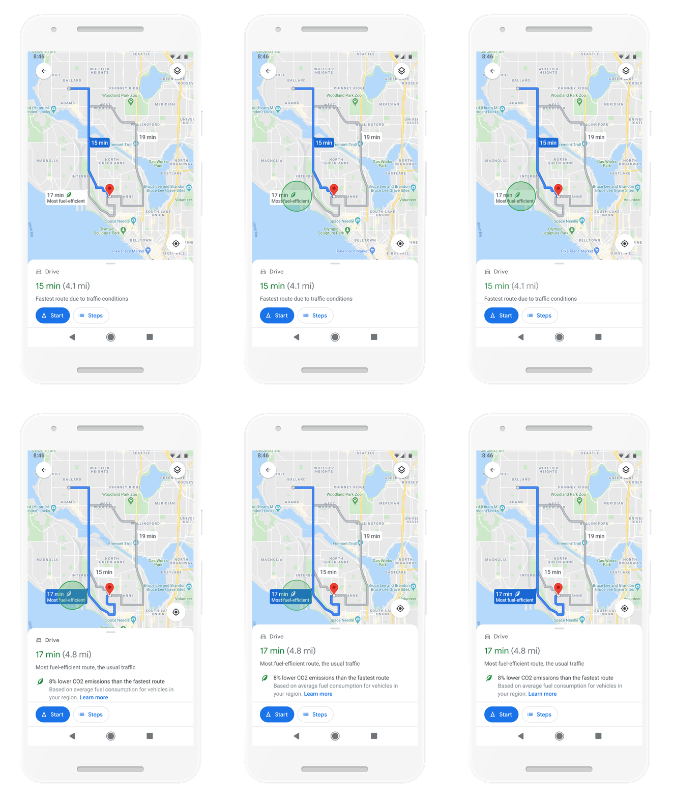
“With insights from the U.s. Department of Energy’s National Renewable Energy Lab, we’re building a new routing model that optimizes for lower fuel consumption based on factors like road incline and traffic congestion,” Google said.

Image via Google
When navigating, Google Maps will default to the route with the lowest carbon footprint when it has roughly the same ETA as the fastest route. Google said you can still default to the fastest route, but you’ll now get info to compare the relative CO2 impact between routes. Maps will also tell you if you’re entering a low emission zone, like in Amsterdam or Jakarta. The low emission zone alerts will launch this June in Germany, the Netherlands, France, Spain, and UK, with more countries coming soon.
Finally, Maps is bringing shopping information to Business Profiles and Search, including delivery providers, pickup and delivery windows, fees, and order minimums. The feature will first roll out on mobile Search with Instacart and Alberstons stores in the U.S.
The indoor Live View feature is available now on iOS and Android. The other features, including weather and air quality layers, will come to iOS and Android in the coming months.
Google Maps - Navigate & Explore (Free, Google Play) →
The post Google Maps gets a ton of new features including indoor AR navigation appeared first on xda-developers.
from xda-developers https://ift.tt/3w64ZDw
via IFTTT
Aucun commentaire: